On May 16, I headed off on the second edition of the
Sunshine 1200k, the first all-Florida Grand Randonnée. Friends had ridden it and liked it in 2015, and it would be new roads and different terrain. There would even be beaches to ride along and sand to walk across!
The route is a horseshoe from Key West, then north along the Atlantic Coast, through central Florida, and ending up at Ft. Myers Beach, on the Gulf Coast. Most riders flew or drove into Ft. Myers and took the ferry to the start in Key West. The route would be the same as the 2015 inaugural, save for three detours uncovered by the pre-riders (a great reason for having a pre-ride!).
With organizer Dave Thompson's caveat on the
event website - "We cannot stress enough that if you are not comfortable riding in traffic, DO NOT SIGN UP FOR THIS RIDE." - and various ride reports, I was suitably braced, and planned to accentuate the positive: the Florida sun, the beaches, the orange groves, and general sunny ambiance. I'll tell you at the end of my story how this strategy worked out.
I flew to Ft. Myers on the 14th, encountering an assortment of randos at the Ft. Myers Beach host hotel.
Ken Bonner in his BMB jersey - fresh and ready to go!
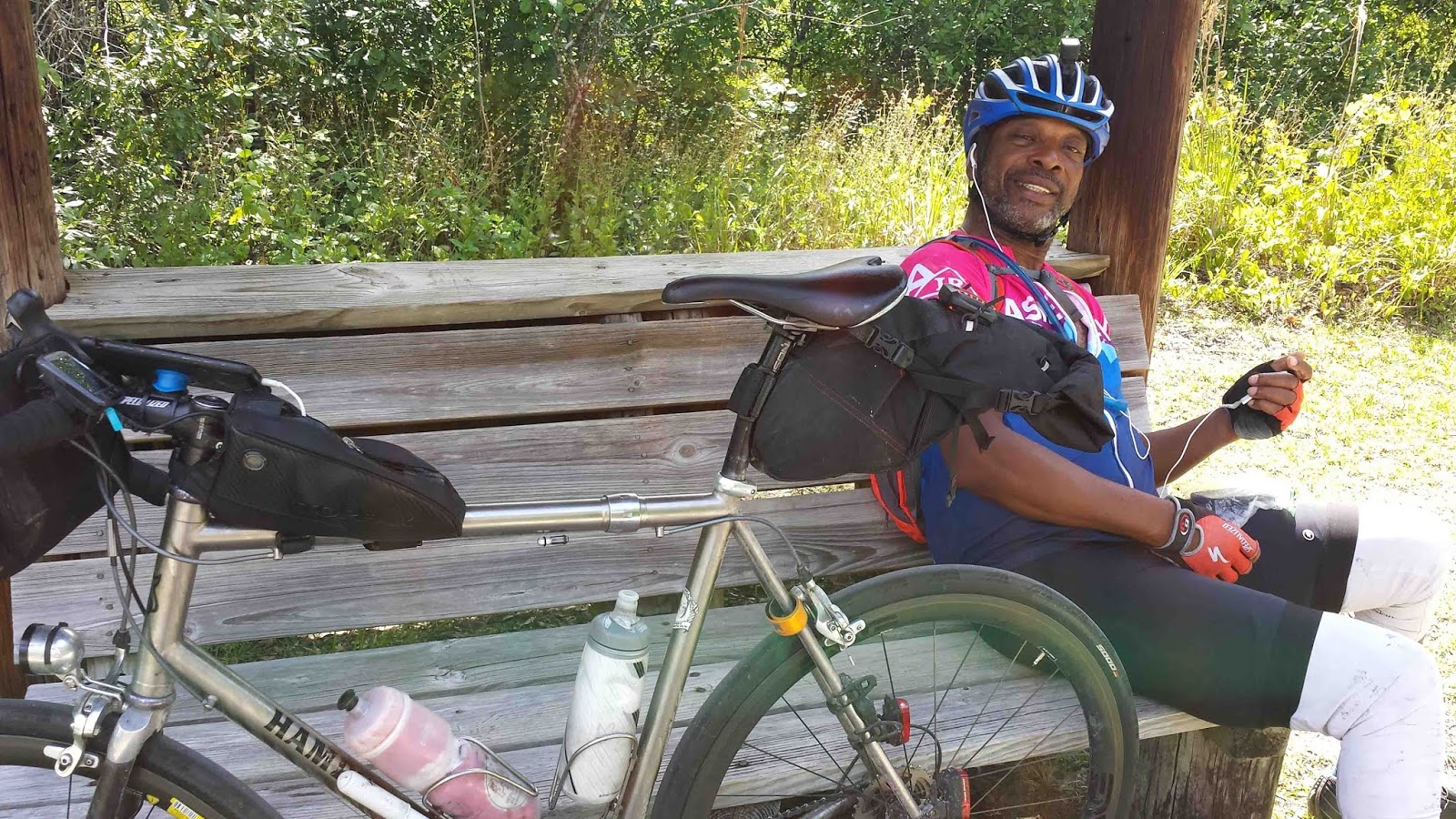
My "before" picture, in fashionable Sunshine 1200 tee
with high-quality embroidered logo
Vincent Muoneke in a contemplative moment in Ft. Myers
The next morning, we headed down to the dock for our ferry ride to Key West. We took our dropbags, while Dave and his crew drove the bikes down in a trailer, to avoid the bikes' being doused in sea spray on the ferry.
Dawn and ready for the ferry from Ft. Myers
The
ferry was fairly fast, with a cruising speed of 32 knots, making for a three-hour crossing. Dave's overland drive with the bikes took five hours.
A speedy ferry, as clear from the jet wash
Dave had arranged a group lunch at a local seafood-oriented restaurant for riders and volunteers. This was a good way to get acquainted, and enjoy good food.
After a group lunch at a local seafood restaurant arranged by Dave, we retrieved our bikes and settled in to the nicely appointed La Concha hotel, probably too upscale for randos. As evening approached, Ken, Vinny, and I enjoyed a perfect pre-ride meal at Wendy's down the street.
Ken Bonner at pre-event evening meal
Stage 1: Key West - Jupiter - 266 miles
The first day was to be a long one, which (we told ourselves) would then set us up nicely for shorter days to come. There were no hills to slow us down, but there were traffic lights in the urban areas. We rode up the Florida Keys, through Miami and Miami Beach, finishing up the Atlantic Coast into Jupiter, a venue used by local brevets.
Stage 1: Key West - Jupiter - 266 miles
A noisy thunderstorm had blown through overnight, leaving wet roads and big puddles the morning of the start. Earlier, the forecast had been for a soggy day on the Keys, followed by afternoon showers on subsequent days. By the time we headed out, however, the forecast had brightened, and we only encountered wet roads and two brief showers on the first day. By the time we reached Miami, brilliant sun was out, and that would accompany us the rest of the ride (except at night).
Temps were moderate, too, 70's or 60's for the lows to 80's for highs (low 90's on the final day). The pre-ride had been toastier.
Obligatory Southernmost Point Buoy photo moments before the start.
I could have brightened this up, but left it murky for effect.
The smart riders biked down the day before for a daylight shot.
After a calm start, turbulent crosswinds from the north accompanied us over
Seven Mile Bridge. We could see a shower ahead of us at the next town, but it receded as we got there (at least for us moderately paced riders). The old bridge, which you could see to the left, is being reworked as a long fishing pier. It used to have a drawbridge to let ships through (not necessary with the new road, which has an arch).
The cycling experience through the Keys was reasonably good, with some maritime views, successive transits of towns that look like most others (plus a succession of billboards offering sandals and beach gear).
Also a few park and beach areas, the bike paths in places deformed and torn up by
Hurricane Irma in 2017.
On many roads, you can choose between a path and a bike lane.
The paths could be the shadier option.
After the second blustery shower, in a region of palm groves we're met by the course monitoring staff, who've encountered a detour they've determined we can just ride through. Think how many minutes that saved and joules of worry!
Weather started to brighten up as we reach Old Cutler Road, a rustic-sounding road through what are now upscale suburbs, wooded and landscaped with interesting homes, and also with a succession of schools letting out (as Dave had predicted). This is a busy road with no shoulder ... but with a bike "trail" - and suddenly we are transported into another ride entirely, a ride of twisting pavement over tree roots, splitting as it winds past giant trees, and makes sharp turns through stone wall entrances.
By this time I have joined up with Josh Haley and Scott Manning which makes all of this more pleasant. Scott on his John Schlitter recumbent found the weaving, the right-angle turns, and the trail forkings around giant oak trees a special gymnastic challenge.
Organizers had suggested for the ride through Miami that we group up for added visibility, so I was glad to be riding with Josh and Scott. We we also joined by Jim Solanick, who is not only a Floridian like Josh and Scott, but lives in this South Florida area and transits these roads on a regular basis.
I have to say that hitting Miami pre-rush-hour was one of the most concerning aspects of the Sunshine 1200. But in our group of four, with the right lane of the main thoroughfare marked with sharrows, and drivers who were used to seeing cyclists, and who weren't traveling any faster than we were, it wasn't bad at all, and allowed us to enjoy the ambiance.
We wait for a ship towed by a tugboat past a raised bridge, giving us a chance to glance up at the skyscrapers.
Waiting at a drawbridge in Miami: Josh Haley
with town cyclists and e-skateboarders
who were happy to socialize during the wait
McDonald's checkpoint in Miami Beach:
Jim Solanick and a collection of rando bikes.
Rider in background is wearing a Florida Tip-to-Tail 1600k jersey from 2018.
One of the local high points near Ft. Lauderdale.
Jim pointed out typical shipping traffic for that area.
It was nice biking along Vero Beach and others as evening approached. Folks were out and having fun, a relaxed atmosphere. As night fell, the route continued up the Atlantic coast, through upscale neighborhoods with impressive spotlighted mansions.
Since these are some of Jim's local roads from his home, he could give a virtual tour as we passed abodes of rich and famous people. Off to our right, we could hear the waves wash in from the Atlantic, and spy breakers through the shrubs and bushes.
A pause after midnight, on the home stretch to Jupiter.
Amazingly late as it seems, we glide into the Jupiter control at 1:06 am. We are the 7th riders to arrive. Shab Memarbashi and Chris Benkly have tasty chicken marsala and rice for us.
Stage 2 - Jupiter - Daytona Beach - 187 miles
Our second day continued ... after three hours' sleep ... with omelets made to order by Shab, and then we were off, already daylight outside.
Dave said that this second stage would be basically a "cruise" ... which it was, and generally delightful. Breezes were east- to southeasterly, onshore. This moderated the temps, and Jim pointed out that the Atlantic sea temps were in the 70's. A big help.
We started with more quiet miles through upscale neighborhoods, dotted by homes of golf legends and other celebrities. Jim pulled over at a convenience store / deli he knew, for more breakfast before it got too hot and we would lose our appetite. Jim ordered an omelet, and I had a
cuban sandwich, properly toasted in a sandwich press, making it crusty on the outside, and mellifluous on the inside.
Jim and Vinny breakfasting in the sun, while it is still mild.
Much of the day will be spent with the Atlantic on our right, and the Intercoastal Waterway on our left. Good company.
Atlantic coastal view
Tropical Way bordering the Intercoastal Waterway
(way in the background)
The VAB is the largest single-story building in the world,
and was constructed to assemble the Saturn V moon rocket.
The Sunshine route originally visited Merritt Island, a nature preserve and home of the Kennedy Space Center, but the pre-riders were told that cyclists weren't allowed on the roads after 6 pm. So the route was altered to take the Eastern Coast Bike Path and the Maytown Spur, 36 miles of path in all. If anything it was more delightful than Merritt Island. But wise to stock up on liquids for those 36 miles without services.
Welcome shade and tranquility
on the Eastern Coastal Path
Night fell as we headed from New Smyrna Beach to Daytona Beach. A full moon reflected in ripples on the Halifax River. The event prospectus said we might dip our feet into the ocean at day's end - and the beach was clearly a hand's throw away - but we contented ourselves with pulling directly into the Oceanside Inn for refreshment.
Stage 3: Daytona Beach - Lake Wales - 162 (+16) miles
On the map, today's inland route looked like it could be the quietest day of the event. That was true for the most part. But look at those spikes on the elevation chart!
I headed out half an hour before first light, greeting the same full moon now setting to the west. The route went through small towns full of large trees and small buildings, reminiscent of many in the South, including in North Carolina where I spent good cycling years.
We stopped at the first checkpoint, at the town of Paisley. Things seemed to be going just great. We turned out to have stopped at the wrong store, but they had friendly service and the best snacks, which only buoyed my spirits further. Then Dave and John Ward Smith pulled up to advise us there'd been an unfortunate
vehicle crash just up the road - at about 7:30 am according to the reports - which would close the road for hours. We'd have to retrace our steps a few miles, an inconvenience, but much more than that for the victims of the crash.
The reroute looked straightforward, and cost us only a net 16-17 miles extra. (It cost later riders nothing, because they hadn't passed that fork yet, and were intercepted by officials. Still, only a modest extra credit mileage for us, which was fine.) The thing was that although Hwy. 44 had a great shoulder up to that point, we soon learned that the shoulder had been milled down for construction. It was the most "focused" white-line riding of the event, but motorists were alert and courteous, as I found they were everywhere on the Sunshine 1200.
What followed was a desultory visit down rustic roads past pastoral farms.
There were two juveniles in tow just around the trees.
Folks out West (like us) travel to see flocks of migrating Sandhill cranes.
Here they are just standing around,
unperturbed by passers by.
At some point, I turned a bend to face a vertical-looking wall of a climb up Sugarloaf Mountain, the highest elevation of the event. But it wasn't that long a climb, there were parts in the shade, and there was a quarter-mile cool down until you reached the control at the top and could look casual and refreshed.
– Sugarloaf Summit –
Under a shady awning, John W. Smith looks on as Dave
either discusses RUSA business
or encourages me to eat more watermelon.
We're now into the rolling, restful interior, with plenty of fields dotted by small towns. It was not unlike biking through areas of South or North Carolina when I lived in Charlotte.
Spanish Moss on trees and fences
Another pastoral scene with shade and trees.
By mid-afternoon, it was time for another bike path treat, the Van Fleet trail.
The Van Fleet Trail is another delightful experience.
Although, incredibly, I turn onto it in the wrong direction!
Delightful nonetheless,
with the minor point that the forest sheltered us from the cooling breeze.
It's not an alligator, roseate spoonbill, or tricolored heron,
but a nice animal to encounter all the same.
Headed the right way on the Van Fleet path, I encounter Vinny taking a break.
Vinny enjoying a shady moment at a shelter
We rode the rest of the path together chatting, a welcome break from the tranquil solitude of the last several hours.
The day drew to a close through rolling orange grove terrain at sunset, finishing at dusk (with lights but in sunglasses, a victory of sorts).
Jim Solanick discusses ride strategy with Scott
while refortifying and then heading into the night.
He will finish towards noon the next day.
Stage 4: Lake Wales - Ft. Myers - 150 miles
A chilly, calm night-time start on quiet country roads. The chilliness (low 60's?) wouldn't last, as this would be our warmest day, but was welcome for the moment.
This was a continuation of the quiet agricultural landscape - a few orchards, mainly pastures - but with a return to the hill-free theme.
As midday toastiness built, I was rationing my water and calculating the ounces remaining in the water bottles, when a hydration oasis appeared on the horizon, set up by Susan Gryder at a fork in the road.
Lorin Fowler not expressing ennui to Charlie Martin
at the Susan's highly appreciated hydration stop
There was yet another detour possibility, which the volunteers had determined we could ride through without issues - a bit of dirt and gravel, but on a nice, quiet road.
Sandy and welcoming sideroads -
not part of the route, just a pause to refresh.
From there it was onto Highway 31, a road with some traffic but a good shoulder.
For me its biggest challenge was flatness and heat at the warmest part of the day. I was counting down the 25½ miles as a kind of exercise (no complaints about the road itself!).
Midway through, Susan had set up a shady spot to pause. I greeted the departing riders, and welcomed those who were just rolling in.
I had met Susan when she rode the Colorado Last Chance 1200 in 2017 and kind of sheparded another rider. Susan had done the Sunshine pre-ride, like most of the volunteers, and then was an ebullient volunteer on the event!
Josh Haley with Sunshine 1200 jersey
behind my trusty Kestrel with blue drink from the previous control
Susan Gryder
The traversal through Ft. Myers was fairly pleasant, on wide roads that were quiet on a Sunday afternoon, then heading into quiet neighborhoods as we reached Ft. Myers Beach. It also helped that a cloud bank rolled in just in time to give some shade.
Dave collecting finishers' cards with congratulations and pizza provided by the RBA
Central Florida RBA Paul Rozelle,
with his daughter Sally, RUSA #9965
Dave told me my friend Larry Midura and I were the only riders to use cue sheets. I had reformatted mine a bit to my own style, and highlighted wildly. Riding with others, it seemed that cue sheets had their advantages in some ways, GPS tracks in others. Oh, and, yes, I had downloaded all four stage maps to my cell phone just in case.
Cue sheet plus helmet light as cue-sheet light
on aerobar of the De Rosa.
Yes, extra miles brought this ride to 790.97.
The Verdict?
This was indeed a fun ride, and extremely well organized (of course).
- Miami and Miami Beach turned out to be fine to bike through, vibrant, and interesting. Other built-up areas were reasonable, too. Looking back, I have experienced as much or more traffic stress on "non-urban" 1200k's (which were great events, too).
- Motorists were careful and courteous.
- The flatness was highly manageable.
- We lucked out on the weather. (Temperature-wise, we had seasonal conditions. Sometimes "average" is lucking out.)
- The beach and pastoral scenes were evocative.
- The cuban sandwich was delicious.
- The ridership, though fairly small, was full of friendly, engaging fellow randos. As one always hopes, there were some friends of many years and some great new acquaintances.
- I did not see an alligator or a manatee, but we'd seen some on our visit last year.
- I am thinking of adding a caveat - like Dave's about urban riding - to the High Country, something like, "If you like oxygen, bring extra along." :-)
A thunderhead at sunset signals a colorful end to our event
Many thanks to Dave and his volunteers for a fun, good 1200k, and to my fellow riders for good company. You can find out lots more on the
Sunshine 1200 website, and see lots more photos on their
Facebook page!
-jle