Weather was ideal, 77º high predicted for Tucson, and 60's at higher locales such as Bisbee. Breezy, but sunny and dry.
The 600k consisted of their 400k route through Bisbee (used on the 400k brevet held three days before), and the Silverbell 200k route which had started off Brevet Week, and which had also been offered weekends between Desert Camps. Silverbell is a new route. (Silverbell is named for Silverbell Road, which is named for the Silverbell Mine NW of Tucson, I believe.)

400k route through Sonoita and east through Bisbee
The dark sploches are "sky islands" while the dark north-south line is the San Pedro river.

Silverbell 200k route heading out Nogales Highway and back via Mission Rd., Saguaro National Park, Marana, and the rollercoaster Camino De Oeste. The whitish blobs are copper mines, and Titan missile base (now a museum).
This ride was appealing because, apart from a few segments of the 200k and the Julian Wash Trail on the 400k, I had not biked any of these roads (but was familiar with much of the roads on the 400k loop from driving around and exploring). It was an inviting combo of newness tinged with familiarity!
An added plus was getting advice on the 400k route from fellow randos Ray Rupel and Corinne Warren, who'd ridden the punishingly windy 400k brevet a few days before, and Michelle Grainger, who had just ridden the Big Mountain Climbs week of PACTour Desert Camp. Billy Edwards had also come down for the 400k.
Not much photo-taking during the ride, but I have augmented with a couple of photos taken at other times.
The Ride! - Heading east on the Julian Wash Trail - part of The Loop of bike/pedestrian trails that encircle Tucson, we had a headwind (expected, down-valley). A small group of us was riding together.

A fanciful "gateway" to the Julian Wash trail,
Rincon Mountains (I think) in the background.
Photo from a circumnavigation of Tucson in December.
Turning south onto the climb up scenic highway 83 to Sonoita, we then also had, yes, a headwind, SW being the prevailing wind of the day. Midway I shed some layers, shortly before reaching a chillier altitude, which is the way things always work, isn't it? The projected high in Tucson was 77º (quite mild), but 60's for much of the middle part of the course, which is higher.
In Sonoita, which is part of Arizona Wine Country, according to a sign on the highway, the checkpoint country store had an ample selection of local wines on display. Also fried chimichangas behind the counter. These are like the chimmies that had served me well on the Texas Rando Stampede, so naturally I took advantage of this opportunity. I won't relate the embarrassing tumble on a curb leaving the checkpoint, which left a bloody knee gash which was worrisome, but which didn't affect the ride, but frightened away small animals.
What followed was kind of a tailwind, heading towards the mountain range at the back of Sierra Vista. One facet of biking here, in the land of "sky islands" (range and basin terrain), is that you can pretty much see yourself as a dot on the map as you wend your way towards or around them.
This first half of the day had high overcast, which was fine, clearing out later.

Highway 82 to Mustang Junction and Sierra Vista
The highest climb of the day was to Bisbee, topping out above 6,000 ft. using the old Mule Pass Road to add that few extra quality feet of climbing. Descending through Bisbee - a fascinating old mining town - was an exercise in care and braking, over bumpy, winding streets. But that's par for the course. Colorado riders will recognize the mining towns of Black Hawk and Central City in this bumpy refrain.

Nice to be able to have stopped at Santiago's in Bisbee as we did in January. But not this time!

"Has The Best Year-Round Climate on Earth"
An interesting claim!
They are at 6,000 ft. in Arizona so maybe so.
We descended through the vast copper mines on the east side of town.
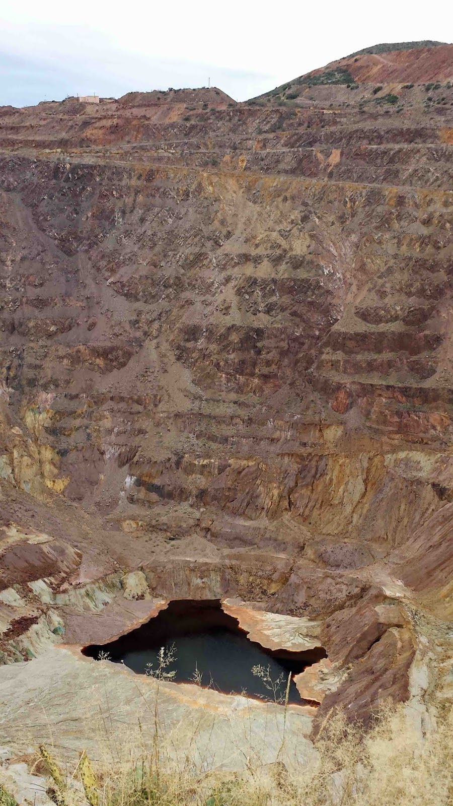
A small part of the massive copper mines on the SE side of Bisbee.
At the easternmost point of the route lies Elfrida, home to the Desert Videoland Oasis checkpoint in Elfrida. It's actually a regular convenience store, too, with nice staff.

A couple of other riders were fortifying themselves for the windward climb, including Tom on the left (sporting a RUSA PBP jersey) who says he's ridden Lon's and Susan's events since the 80's.

The windward climb on the Gleeson Road was scenic but slow work.

But no doubt not as slow as for the 400k riders those few days before fighting the fiercer winds. The summit over a hill range was so picturesque with prairie grasses near sunset!

Nothing like those long shadows to make you reflective. Only seven hours to go! (For the first loop, that is.)

After this photo, I added an extra taillight to the trusty Kestrel, and donned reflective attire.

This was among the most inspirational segments of the brevet!

Dusk came on at Tombstone, and then, just north of town, the turn left onto highway 82 just before a Border Patrol checkpoint (making it easy to identify our turn). From there we had blissfully smooth pavement and light grades across the San Pedro valley to Mustang Junction.
At that point, who was to step out of the shadows but Dave Jordan, RUSA #4, with upbeat commentary and talk of RUSA things long past. A thoroughly enjoyable conversation!

Dave Jordan at Mustang Junction
Susan had told us that we could phone ahead from Mustang Junction if wanted something like a grilled cheese sandwich at the Sonoita control. So I did. Dave said he'd supplied homemade bread, so they used that for the grilled cheese.
Sonoita - Susan and Lon were stationed at the Santa Cruz County Fairgrounds in Sonoita, and provided the delicious grilled cheese sandwich on homemade bread and hearty potato soup, too, plus fine conversation. This is a tough stint to staff, with the wide range of rider times coming through this checkpoint, in kind of a chilly pocket, too. They were affable and charming as ever.
After putting on more layers, the climb out of chilly pocket of Sonoita was warming. The Border Patrol agent just past the Empire Ranch turnoff waved me through, after I was auto-photographed.
The descent to Vail also just fine, very light traffic, and the 18 rumble strips in the curvy section kept one alert.
The twists and turns of the Julian Wash Trail went well, too, after I tried to commit the twists and turns to memory early that morning. I'd also biked it in December, on a circumnavigation of Tucson.
Arrivée (for the first loop)! The gracious clerk at the Country Inn and Suites came out from behind the desk and helped me into the elevator for the trek up to the motel room. Maybe I looked worse than I thought!
Silverbell 200k Loop - After a brief, luxurious snooze, it was a sauntering 200k to finish things out. The route starts out flat down the Nogales Highway past pecan groves.

This is actually on Old Nogales Highway.
Notice the new plantings between the mature trees.
Next came climbs in a modest way west of I-19, past the Titan Missile Museum, and then up Mission Road. It is now Saturday and there are bunches of cyclists out and looking fast and cheerful.

Duval Mine Road heading up into mining country.

Mission Road passing more mines - the terrain feature ahead is from a mine.

Site of an info checkpoint on my Mission - Madera Canyon 200k perm, which I would try out a few days later. Just an excuse to stop and take a break.

Another view.
I love the expanse of sky over desert!

Helmet Peak (aptly named) skirting our route.
We then headed up Kinney Road and through Saguaro National Park (West), which was a treat, great scenery on silky smooth pavement!

The half dozen miles to get there were an adventure, however, with "enthusiastic" traffic. I assumed they were heading for the Arizona-Sonora Desert Museum, a popular and wonderful nature establishment, but they were going for Old Tucson, a former movie shooting location, and now an entertainment venue. After passing that, all was well.
Next came the agricultural flatlands of Marana (including some aircraft graveyards which were especially interesting!), where cotton and other crops are grown, and then a survey of the Arizona northern exurbs, pleasant in their own way.

An info control in greater Tucson, planned developments flanked by desert terrain.

Fellow participants Matt and Brett resting at the penultimate control, at delightful Feliz Paseos Park, which has good views, and where you can see javelinas, at least judging from their webpage.
The finish went just fine, gliding back into Tucson airport territory and into the host hotel.

Susan Notorangelo, taking out a moment from busy event prep!

Lon Haldeman and the big PACTour trailer!
I thought this would be a good brevet. Despite some winds and some rough pavement, I ended up relishing and enjoying it highly.
Susan and Lon provide superb organization and that personal touch which enhances your experience. It makes you feel good on the ride. It was very nice to see them again.
-jle