Monday, December 14, 2020

Foreign Grand Randonnée Round-Up for 2021!

Les Randonneurs Mondiaux (LRM) has published their 2021 calendar of Grand Randonnées.  It lists 71 events in 30 countries. They caution:

DUE TO THE COVID-19 PANDEMIC, LRM EVENTS MAY BE UNCERTAIN. IF YOU WANT TO RIDE ANY OF THESE, PLEASE CONFIRM THE STATUS OF THE EVENT WITH THE ORGANIZER.

A sampling around the globe:

  • 15 in Australia (including the Great Southern Randonnée, and five Trans Oz 4000k's)
  • 3 in Brazil
  • 3 in Canada (Ontario and British Columbia)
  • 6 in Russia
  • 3 in Spain
  • 7 in Ukraine
  • 2 in the UK (Inverness, and Land's End to John O'Groats)
  • 7 in the US, as described in our US Grand Randonnée Roundup.
India has none on the calendar yet (vs. 18 in 2020), which may reflect the current status of the virus, as their events are early in the calendar year.

The Great Southern Randonnée in Australia is listed as two events - an evening start and a morning start - so it will be interesting to see how the separate rider pools are managed, and how easy it would be to switch between one and the other.

Finding Out More - The links and info vary. Some links go directly to dedicated pages for those events. Others go to the country organization's home page or the organizing club's home page, where you may have to dig a little to find event info. And details may be understandably in flux, or not yet updated for 2021.

The AJ Hokkaido club site says they've already 
postponed the Okhotsk 1300k to 2022

Travel Considerations - It will remain a challenging and changing travel landscape as 2021 unfolds. For example, as of this writing, most travelers to Australia - including residents of Australia - must quarantine for 14-days at a government approved hotel. Policies everywhere will evolve, of course, as will travelers' comfort level. It all means extra planning to do and added decisions to make.

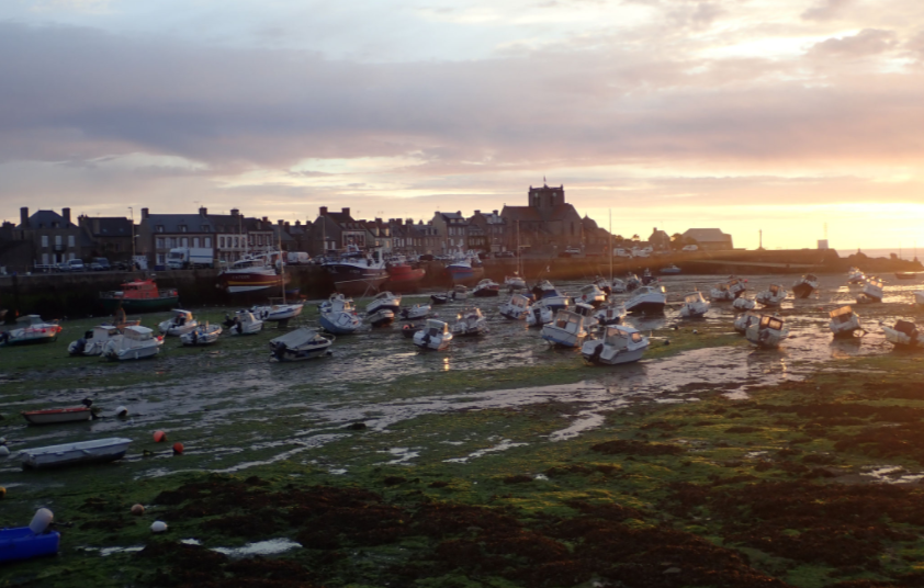
Visit the Trio Normand page 
to find out about the Normandie 1200

Calendar Volatility- In their fall update, LRM reports: "In 2021 LRM will be very liberal about allowing changes, postponements, cancellations, or even new events." (The same holds for the Audax Club Parisien regarding brevets and flèches, so if you are thinking about a foreign ACP-sanctioned event, make sure to keep up on when/if it's being scheduled. And our domestic ones, too, of course.)

- - -

Stepping Outside the Normal Paradigms - We think of Grand Randonnées as following a few typical patterns, over the most typical distances (1,200 km to 1,400 km). But some are much longer - such as the Trans Oz 4000k's. Others have certain concepts - such as the Scandinavia 1200 which visits all the Scandinavian countries and features successive ferry crossings to reach them. A few examples ...

 CASE STUDY   Les traversées de France - La Réconciliation - Each year, "Les traversées de France" offer a randonnée "following a route linked to a certain historical theme and to discover various points of interest (landscape, architecture, memorial, geographical or gastronomy)." La Réconciliation (2021) is 1,607 km and is linked to French-German reconciliation after the wars. 

You can ride 280 km per day for RM credit, or 200 km per day as a Permanent. You can start on the official date, or choose this or another date to ride it as a Permanent. Their webpage is interesting reading. (The German description has the most info; the English is the sparsest; French is in between. It helps to read all three to piece everything together.)

 CASE STUDY   Land’s End to John o’ Groats (LEJOG) 1400 km - Land's End to John o' Groats is a longstanding route from the southwest tip of the UK to the northern tip. It's an even more expansive experience than LEL, because being point-to-point it covers more regions - from Cornwall through the Cotswolds, the Midlands, the North, and finishing off in the Scottish Highlands, a windswept land of glacial lakes and an economy of trees. A succession of different terrains, architectures, and history. And Celtic lands at the start and finish.

John o' Groats 

You can ride it with Audax UK as a grand randonnée. But there are also tour outfits that take you on the route, or you can ride it independently (with friends, or alone as I did). Back then, I wrote to the CTC (Cycle Touring Club, now CyclingUK) who sent me a route packet. I overnighted mainly in B&B's. Today, Cycling UK will send you a packet and they have online info and a chat forum. Here is their info. This is by no means to detract from the rando event option, an alluring opportunity to ride an iconic route as a randonnée event!

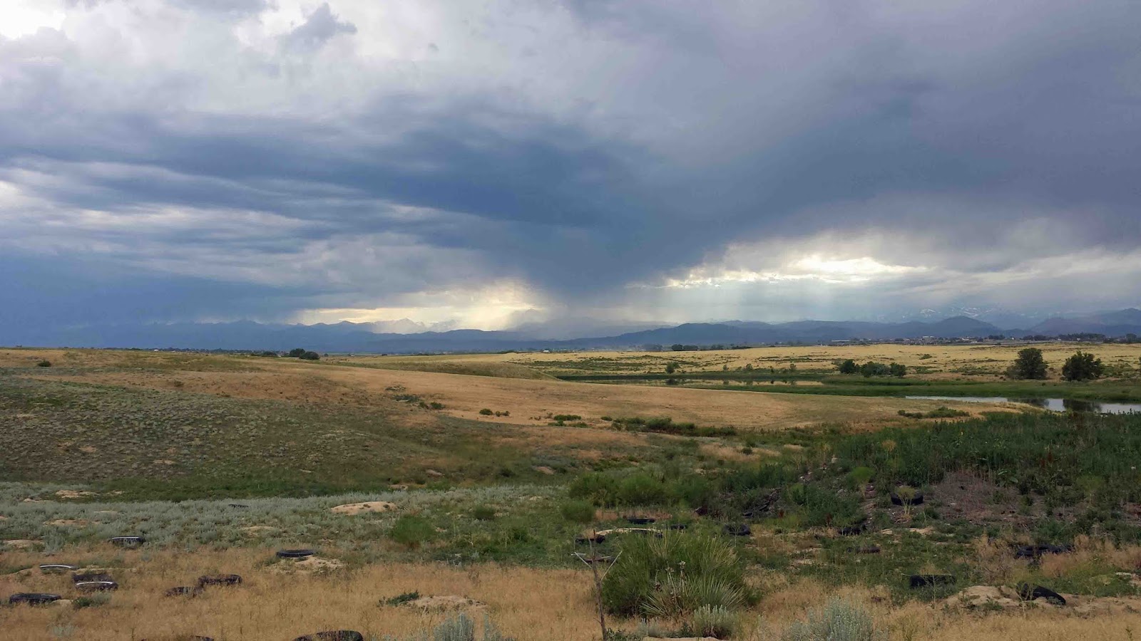
 CASE STUDY   Trans Oz 4000k's - An unsupported grand randonnée from Fremantle on the SW coast to Bondi Beach on the SE coast. The website tells us, "Be prepared to suffer long daily distances, endless flat and straight roads, boredom, loneliness, cold, rain, headwinds, tailwinds, road trains, wandering cattle, camels, emus, wombats, and kangaroos, overpriced accommodation, average food, and sometimes questionable water quality." No intermediate checkpoints, but you'll need minimum average pace of 200 km/day to finish officially. 

Great Eastern Highway, 
courtesy of Google Street View

- - -

So, lots to think about if you're considering a foreign randonnée in 2021. We hope that it will be possible to make good plans and have memorable rides this coming year!

-jle

Tuesday, October 27, 2020

Grand Randonnée Round-Up for 2021!

It's only October and yet the snow has already been flying- so it's time to ponder and plan for next year!

This year's Grand Randonnée Round-Up for the US is easy to produce, because it's six of the eight Grand Randonnées scheduled for 2020. All of the six were cancelled, so they're coming back for a second try (including ours!). Of the other two, one actually took place in 2020, sans RUSA sanctioning, and the other isn't scheduled for 2021. I'm still flagging as  NEW  the ones whose inaugural edition will (hopefully) be in 2021.

The six US 1200k's scheduled for 2021:

July 12
July 14
August 1
September 16
Crater Lake  NEW September 17
Cracker SwampNovember 4

Foreign Grand Randonnées - The Randonneurs Mondiaux calendar for 2021 has not yet been published. After it is, I will update this space. Meanwhile, two Canadian Grand Randonnées are planned:

a BC Randonneurs 1200k (July 10)
the Manitoulin 1200k in Ontario (August 12)

- - -

If you are riding a Grand Randonnée, some awards for extra motivation:

Finish two US grand randonnées in the same year.

Finish four different US grand randonnées - over any number of years

Finish a US grand randonnée, a populaire, a team event, 200k, 300k, 400k, 600k, and 1000k, and enough extra to add up to 5000 km in 24 months.

Finish PBP, another grand randonnée, a Super Randonnée 600, two Super-Randonneur series (with 1000k's), a Flèche, and other events within six years.

RM Challenge Lepertel  NEW 
A 1200 km or longer event in each of 4 consecutive calendar years.
Les Randonneurs Mondiaux has relaxed the requirement to complete a grand randonnée in each of four successive years. You can make up the year 2020 by riding an extra grand randonnée in a successive year.

And now some details on the US grand randonnées ...

Sunday, July 19, 2020

Rillito - Pantano - Saguaro Sashay 100k - inaugural ride!

On February 20, 2019, I tried out my new Rillito-Pantano-Saguaro 100k perm populaire in Tucson!

I'm only publishing now, 16 months later - because I forgot it hadn't been finished and published.

The preponderance of the route is on the river park trails (Rillito River Park Path and Pantano Wash Park Path) plus the delightful Cactus Forest loop in Saguaro National Park (East).

So while on a map the route may look urban, that's not the riding experience. And this was my goal in designing the route. Smooth pavement, tranquil miles, and a scenic cactus experience.

Catalina Mountains to the north-northeast, and Rincon Mountains to the east / southeast, which borders Saguaro National Park (East).

After the mile on Ft. Lowell Rd. and mile plus on Mountain Ave., we're welcomed by the Mountain Avenue Bridge (no motorized vehicles) onto Rillito River Park Path (north bank).

This gateway is just one example of artwork along the trail.
Catalina Mountains in the background.

Serene spur down the Rillito path to Mile 0 (and a checkpoint).

Sand on path after high water from rains. 
This isn't on the actual route, so I don't know why I included it,
but that's how it is on the river park trails.
This gets cleared away quickly by park staff.

Heading back east on the Rillito River Park trail.
Now it's a 1% grade uphill.

Pantano Wash trail has a sequence of evocative Commemorative Tree Parks where folks can sign up and plant a plant in honor of someone (with a numbered plaque in front - the photo above shows the key to the plots - and often a photo of the honored person). 

Here's one with some Christmas decorations left over.

Next it's the two miles up Golf Links Road, with places for food and drink. Then the sinuous Old Spanish Trail Road, such a departure to the grid system of Tucson proper.

At the entrance to Saguaro National Park (East), there is a visitors center with water, restrooms, and brochures. At the entrance, show your pass or pay your entrance fee. (Or if it's before 9am or  8am, there's no staffing.)

Cactus Forest Road - the high point of the trip - 
no need to rush through this!

But that first dip across a dry wash gets your attention!
Rincon Mountains in the background.

In the course of the Cactus Forest loop, you dip, climb, and wind around, to the western flank of the Rincon Mountains. You pass trailheads heading out into the park. Motor traffic tends to be slower than cyclists.

Before now, I had not ridden this loop. We had only driven it. Seemed like it might be harrowing - especially with signs like the above - but it turned out to be fun.

View of the Tucson Mountains to the west.

Javelina Rocks plaque - I have not seen javelinas in the park, 
but am sure they are there.
They are not in the pig family.

Javelina Rocks view

After a stop (checkpoint) at the Tanque Verde Ridge trailhead, it's a fond adieu to the park. 

This was the original Saguaro National Park tract. At the time, the cactus and other vegetation was in decline, from livestock and from a big freeze one winter in the early 20th century. But now it is a lush Sonoran Desert landscape.

The way back is downhill all the way to Mountain Ave.

Actually a dawn view. 
You might see something like this towards the end of your ride if you started later in the day.
Notice actual water in the Rillito River (after rains, or maybe mountain snows).

This is a 100k you can do year-round. In the summer, starting before 6:00 am means it's only getting toasty towards the end of your ride.

- - -

My friend Lynne Fitzsimmons, from Portland, OR, rode this route when she was visiting Tucson. Here is her write-up with photos!

Perm Pop in Tucson - Lynne Fitzsimmons

-jle

Sunday, July 5, 2020

A Poudre Canyon DC

On June 24 - with the promise of great, summery weather, and a solstice-length day - I headed out on essentially our Poudre Canyon (Rustic) 400k brevet route. It would be a good stretch of the legs, and a way to reconnect with longer brevet distances!

Poudre Canyon past Mishawaka

A giant burger the night before on a jalapeño - cheese bun provided nutritional inspiration.


3:57 and a mild start from the Dale Estate, swinging by the brevet start in Louisville. Temps in the mid to upper 50's under clear skies. Pretty much perfect.

Pre-dawn light descending 95th St.

Dawn on 75th St. 

A sunny morning on Glade Road to Masonville

Quiet on Horsetooth ... both on the water and on the roads!

Stopping at Ted's Place rather than Vern's because it seems that their convenience store has been closed during the virus.

A warm, tailwind climb up a quiet Poudre Canyon. The rafting companies have plenty of business, but it's not as frenetic as on the weekends.

Here is that shot again, of Poudre Canyon beyond Mishiwaka and before Stove Prairie Road.


Around the bend, flaggers were pausing traffic for scaling work at the rock tunnel. After waiting a few minutes, I asked the flagperson about wait time. He said he couldn't tell - could be five minutes , fifteen, etc.  Some of the notations on the rockface indicated possible explosive work in its future.

Doubling that potential wait time - because of the return trip from Rustic - persuaded me to turn back ... even though the stretch to Rustic was the high point (literally and scenically) for the trip. Call me the impatient rando. :-)

This turned out to be a mile or two less of Poudre Canyon than on the Stove Prairie 200k from April. Oh, well. 

I did explore the exciting new reconstructed stretch of Owl Canyon Road with smooth asphalt and full shoulder (an improvement over no shoulder). 

And the exciting snake warnings at the Rawhide Plant, a reminder from the winter Rawhide Ramble 200k brevet, when the snakes would probably have been in torpor.


This sign was also a reminder of a similar snake warning on the lovely Rillito River Park Path in Tucson, a venue we have had to forego this spring and summer because of the virus.

Rillito River Park Path - Mountain Ave. bridge - at dawn
Catalina Mountains in the background
Can you imagine an ice warning here?
But it's actually possible.

Actual water in the Rillito River

Back in Northern Colorado ...

Services and precautions at the Kum & Go in Wellington were very good. Widespread mask usage, and the pizza slices were fully enclosed and wrapped up tight. Also, to fill your water bottle, they gave you your own large plastic cup to get water from the vending machine - no direct contact with your suspect water containers. Nicely done.

I am not sure I have ever pedaled so slowly downhill on the I-25 frontage road, as SW winds kicked up - desiccating winds, I might add.

I always love the quiet stretch of Weld County Road 23 heading down to Severance, after getting off busy Hwy. 14 (albeit with nice concrete shoulder).

Here is a picture of the wetlands along CR 23, where I stopped to photograph a yellow-headed blackbird. It's one of my favorite birds, and reliably found right here during migration. By the time I had coaxed my phone camera into action, however, the yellow-headed blackbird had (predictably) departed.

Wetlands north of Severance

In Severance, already out of water, I stopped at the store, where the clerk was extremely polite and helpful, really a welcoming store and friendly small town.

Climbing past Milliken, virga had started to form above the foothills. That was ok, because the weather people had predicted that storms would stay in the mountains.

Rd. 19 outside of Milliken

Showers began moving down the foothills. Good thing the forecast was for dry on the plains!


After a few glancing blows, however, one shower hit head on, with gusty winds and drenching precip.

Rd. 20 at I-25

Well, in the end not 400k but a good double, 203 miles, and a fine use of the day!

Bike shoes drying in the sun
the next morning.

Hope you're able to stretch your legs, too.

-jle

Tuesday, June 2, 2020

A Climb to Brainard Lake

On May 26, I made my first-of-season climb to Brainard Lake.

My first-of-season bird up there was the gray jay - even before I took out my sandwich, which is a magnet for gray jays, a reliable denizen of this altitude. I heard tweets that were probably migrating warblers, but didn't see them.

It's an ideal time to be at Brainard, since the campgrounds and day use areas aren't open - under 10 feet of snow at the moment - and perhaps wouldn't be open anyway, in this Time of the Virus.

Climbing up to Ward, you reach the early bright green just-unfolded foliage near Ward at 9,000 ft.


The evidence that spring is finally here! 
And that summer is coming.


But no leafing out yet at 10,000 ft.

Near the entrance to Brainard Lake.

At Brainard: plenty of cars in the parking lot before the entrance.

And then that classic first view of the Indian Peaks.

Brainard Lake Road just past the entrance hut


Higher roadside snow passing the closed campgrounds

Looks like a while until Day Use will be open.

(The clear roads are only clear because of plowing.)

Not plowed across the lake outlet bridge

South part of lake loop - time for a break!

The snowfield provided warming rays while I took a moment for a sandwich.


Among the few folks on bikes were (1) an angler with fishing gear headed to the lake and (2) a mountaineering skier with backcountry skis heading to a trailhead.

Heading back for a chilly but delightful descent.

Here's hoping you can enjoy a cool get-away on this eve of summer!

-jle

Wednesday, May 27, 2020

A Climb to Wind River Pass

On May 22, I decided to climb up to Wind River Pass, chiefly because it was a wonderful, bright, and blue day, perfect for the mountains. Also to ride a newly-reconstructed section of Hwy. 7 for the first time.

After heading up a quiet St. Vrain Canyon, over the also recent resurfaced Hwy. 7 to Allenspark, some stops along the way ...

The Ferncliff Store remains closed as it has been lo these 20 years. I remember good home-baked pastries they offered inside when we first moved here. But a new sign has appeared, advertising a new liquor store next door. So Ferncliff is showing signs of life, in that respect.

Side of the Ferncliff Food & Fuel

Complete with cheerful bread, gas pump, and drink!

At Allenspark, Crystal Springs is open, unlike the spigot in Ward.

As usual, folks were lined up to fill large containers. Normally in spring, Crystal Spring is unavailable for a short time during tests for turbidity, but we're past that now.

Crystal Spring in Allenspark

Across the street, remodeling by the new owners continues of what was the Fawn Brook Inn.


It was a joy to climb past Meeker Park on the new segment. It now has a nice shoulder, and new, smooth pavement has replaced the potholes, rough surface, and glacier-like fissures of the old road (which had gone from bad to worse thanks to the 2013 flood).

This project meant new culverts, clearing and grading, and of course widening the road itself.

New segment of Hwy. 7

Mt. Meeker looking good, plenty of snow left.

Ditto for Longs Peak

Wind River Pass was my turnaround point, at 9,150 ft.

The stretch beyond this, past Lily Lake and through the rock cuts has been resurfaced (great!) but still doesn't have a shoulder. Dynamite might be needed for some of that.

Time for a bite of sandwich and judicious drink, sparing just enough liquid for the descent back to Hygiene.

Wind River Ranch in front of Twin Sisters

And what a smooth, delightful descent!

Two bottles of Gatorade at the Hygiene store (Mtn Ftn) - the only external contact on the entire ride - provided enough rehydration for the home stretch.

Face (homemade) mask now part of the outfit!

The Lyons to Estes-Park to Glen Haven route, of which this is a part, is a components of the Glen Haven Gallivant 200k Permanent, and the St. Vrain Canyon 400k and 600k brevet routes. Now that Hwy. 7 beckons again, we can start running these routes again ... once perms and events are reactivated, that is.

Meanwhile, I hope you will get a chance to enjoy this stretch of road yourself!

-jle