Monday, April 9, 2018

Two in Tucson: #1 - Picture Rocks

In December, 2017, my wife Pat and I spent a few days in Tucson, for a winter getaway from Colorado. I was fortunate to ride two of Roger Peskett's 100k perm populaires.

This is about the first one: the Picture Rocks 102km Permanent Populaire.


As you see, it traverses Tucson Mountain Park and Saguaro National Park. But the name "Picture Rocks" was the big draw for me, as it was bound to be picturesque!

Weather when I rode was seasonal: 50's to 60's, and partly cloudy to sunny.

From a north section of Tucson, we make our way to the loop trail, with an info checkpoint at a non-traditional bike shop perched on the trail at the edge of the Santa Cruz River.


The trail was one of the highlights of the route. Lightly traveled, a few cyclists and joggers, with nice riparian views.


Nice views and some shade, too!


The second checkpoint was at a courtyard of various cafés and other places to enjoy the passage of time, as a number of cyclists were doing when I breezed through.


The second highlight for me was climbing Gates Pass (3172 ft.). A few stiff sections, but really a delightful pass with low traffic and fine scenery ... 


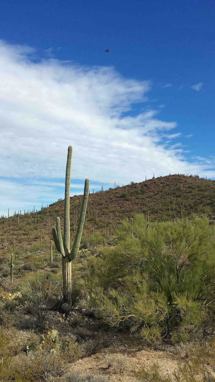
... and our intro to saguaro country for this ride.


Nice views from the pass into the desert hinterlands beyond Tucson.


A plaque explains that local rancher Thomas Gates explored a way over the Tucson Mountains west from town, and found this pass. While at the close of World War I there was a flurry of local interest in spreading west of Tucson to establish mining and agricultural claims, Gates sought to preserve some of this landscape, and succeeded, resulting in what we see today as this Tucson Mountain Park, adjoining Saguaro National Park.

The national park is the next stop, replete with lots of info on saguaros, their place in Native American life, and local flora and fauna.


There are various side trails and items of interest at the visitors center, to peruse at another time. Here is a tour of cactuses.

The pavement through the park was a joy to ride, and a contrast to most of the roads in this area, which were quite rough with expansion cracks.


Out in the Picture Rocks area, it was a broad expanse dotted by rock formations. This is a desert agricultural area with lightly to moderately traveled roads mostly with no shoulder, and very polite traffic. This route avoided another feature of Tucson area roads: the roller-coaster traversal of washes, which make driving and cycling some mixture of fun and adventure.

This not very good photo shows a field of cotton backed by one of the rocky ridges.


The rest of the trip featured a segment down the I-10 frontage road, then final miles in town on roads with traffic but bike lanes.

I chose this Wienerschnitzel restaurant as the finish establishment.


Among the many offerings, they had a special on corn dogs, which was my choice.


I enjoyed this route overall, a great sampler to biking in Tucson and the Tucson area, and especially Gates Pass, Saguaro National Park, and the Tucson loop trail.

-jle


Tuesday, April 3, 2018

John Mangin's Colorado SR600 Tips!

At the beginning of last September, John Mangin became the third rider to complete the Colorado Front Range Super Randonnée 600. Here are his tips! These are geared to a two-stage ride, 300km to Woodland Park, sleep, and return:

  • Start early.  I started at 4 am, 3 am might have been better to allow for more natural sleep in Woodland Park.
  • At the bathroom station in Nederland there is now a water fill station on the north side of the building.
  • Woodland Park makes a lot of sense for the overnight.  Most restaurants close at 10pm almost everything by 11pm.  I ordered Jimmy Johns subs delivered to the hotel so I had food when I got there.  I did not have to ride to get food and also had a sandwich for day 2.  Had I started at 3 am I would have arrived before the County Market closed at 10pm.
  • It will be chilly riding to Deckers on the return.
  • Check the open hours at Deckers.  I was there around 8:30 pm and the restaurant was still open.  This won't be the case on the return.
  • Potentially very important:  At the mtb trailhead for Buffalo Creek there is a tent with snacks, water, Gatorade, and bike tools.  I was able to get a spare water bottle, which was important due to the heat.  On the return ride, if Deckers is closed, this could be very useful.
  • Witter Gulch is tough.  Not much more I can say about that!
  • I hit Echo Lake during the day both ways so it was open but this would be a control to check the hours on, depending on when one starts.  I was almost empty from Conifer to Echo Lake, but it was also hot.
  • There are plenty of service in Idaho Springs.

I think being very familiar with the route is important.  There are plenty of services along the way and I never had any trouble with food or water, despite temps that were in the upper 90's.  I did have a 100oz camel back, and this proved to be a good choice due to the heat.  I would also suggest a hard look at gearing.  This may seem obvious, but I made some changes to my drivetrain for this ride and it made a major difference.  

Be prepared to ride slow.  This is difficult mentally, for me I figured I would have the right mindset after LEL and that proved valuable.
I did not hit any inclement weather but there is obviously potential for that.  Aside from the heat I had near-perfect weather.  It was still very cool in the early mornings.

I will say that this is a spectacular route and well-put together.  It seems remote but there were always services close by if you know where to look and consider open hours.

John's bike at the Eldora checkpoint

From John's and Corinne's experience riding in early September, it does get colder at night than in mid-summer. But the days are reasonably long. For my July ride, I started at 3am, which did work out well.


Congrats to John, and encouragement to future aspirants!

-jle


Saturday, March 10, 2018

3 Perms - OK Panhandle, Guanella, Kona - Pololu!

 Here three recently-approved perm routes to tickle your imagination! 

#3547 - Oklahoma Panhandle Patter 105km Perm Populaire

The Oklahoma Panhandle Patter (RWGPS route) is a point-to-point permanent populaire from the SE corner of Colorado, through the Oklahoma Panhandle, into the Texas Panhandle. It is admittedly designed to tag any of these three states you do not have for the RUSA American Explorer award.

In Colorado - notice remnant of spring snow.
Note: not all of the route is this flat!

Landscape is some flat, some cliffs and hilly terrain, some agricultural, some grazing, yucca plants, rocky outcroppings. It's quite open and expansive! The only intermediate services at all are in Boise City, OK, which is why our route goes into that town rather than taking the bypass.

Boise City was also a RAAM (Race Across AMerica) timestation a number of times, this stretch being a trying period for riders who've survived New Mexico or the Rockies, and now face the prospect humidity and flying insects ahead ... and more climbs!

US-287 is in excellent shape with wide shoulders. It's concrete in Colorado. There is some truck traffic, on the whole light traffic overall.

A 210k out-and-back route would also be possible. Also a 150-mile / 240km four-state loop including Kansas is conceivable.


♦ ♦ ♦

#3546 - Guanella Pass Gambol 100km Permanent Populaire

The Guanella Pass Gambol (RWGPS route) is an out-and-back over Guanella Pass (11,670 ft.) with 7,200 ft. total climbing.

The segment to/from Downieville and Georgetown is fairly shallow in comparison with the rest of the route, and is included to reach 100km. It also gets you warmed up outbound.

There is a jog at the pass to Square Top Lakes trailhead - yes, we needed that extra couple tenths of a mile; perhaps you will be encouraged to hike this alpine trail (another time, not in the middle of the ride)!

At the turnaround in Grant, there are BBQ and other places to eat.

Choose fine, stable weather to ride this one!


♦ ♦ ♦

#3522 - Kailua - Pololu Lookout 202km Permanent

The Kailua - Pololu Lookout 202km Permanent (RWGPS route) is an out-and-back featuring the North Kona coast on the island of Hawaii.


This route spans the fairly built-up area of Kailua-Kona to the more sparsely settled North Kona area, to the old (former sugar cane) village of Hāwī on the north end of the island, and to Pololu Lookout on the windward side (lush and moister). Most of the route is on the sunny, dry, volcanic Kona coast.

Modern resort life on the Kona coast.

Pu'u wa'a wa'a volcanic cinder cone above the clouds,
viewed from north Kona coast.

Pololu Lookout on windward side. 
A sheer dropoff and roadless valley beyond your turnaround point.

You can also start from Hāwī if you're staying there, or one of the resorts midway up the coast.

Services are not a problem - available in Hāwī, at Kawaihae, the resorts, and in Kailua. Just remember to stay hydrated and bring sunscreen.

-jle

Map images © Google Imagery, Terra Images; routes produced by RideWithGPS.


Wednesday, March 7, 2018

Riding the New Smyrna Beach - Flagler Beach 115k

In late February, my wife Pat and I visited Florida. One thing we were aiming for were natural areas such as the Merritt Island National Wildlife Refuge and Canaveral National Seashore (and no, we missed seeing a rocket launch, but we did see small alligators, sanderlings, and roseate spoonbills).

I also got in some biking, including Dave Thompson's lovely New Smyrna Beach to Flagler Beach 115km Permanent Populaire. This route takes in the Intracoastal Waterway, Atlantic beaches, and a nice forest.

This map, courtesy of Google and RWGPS, belies a route that's more interesting than it might look.

It's a nice, sunny start around 70º near the Intracoastal Waterway.


After a brief stint on US-1, we're on roads bordering the waterway.


Beach St. is a quiet road bordered by modest homes on one side and shoreside parks on the other.


Next up we veer into more remote-looking environs: Bulow Creek State Park. Light, polite traffic, and a smattering of cyclists.


The overarching trees provide welcome shade. There are signs here and there posting minimum height clearance (like underpasses have). Dave says the canopy has been thinned out some by successive hurricanes. So it must have been a shade paradise before and may become so again!


After climbing over the Intracoastal Waterway on one of those high arcing bridges, and zooming into Flagler Beach, I stop at the 7-Eleven (after bypassing the much more interesting looking "6-11" store, and an inviting barbecue place on the corner). 

At the 7-Eleven, I've caught up with three riders - each sporting tri-looking bikes with deep-dish, low spoke count wheels - who had waved earlier as they passed me on Beach Street. As I munch pizza, one of them asks if I'm on a randonnée. Turns out he'd ridden some brevets, including one of Paul Rozelle's 300k's, which as he recounted involved sudden downpours of chilling rain, and street flooding. He expressed interest in getting back into our sport. All of the three riders were fit and extremely good natured, and really brightened my ride.

Flagler Beach (named at least indirectly for the creator of the Florida East Coast Railway, which until the 1935 "Labor Day" hurricane extended through the Florida Keys)

And it's on to another quiet, wooded lane (John Anderson Drive).


The Atlantic coast segment is a succession of modest, well-kept, 1960's and 1970's neighborhoods,  punctuated by high-rise condos and resort lodgings.


Back over the Intracoastal Waterway, on either the highest or the second highest point in the route, depending on which bridge is higher. It's a nice vista.


And a final stretch back on Halifax ...


... before a pleasant finish on Highway 1.


A big thanks to Dave Thompson for the route, his tips, and the loan of his backup bike.


I really had a nice time on this intro to Florida randonneuring, and am encouraged to do more!


-jle


Saturday, February 10, 2018

Colorado Rando Awardees - 2017 Round-Up!

Here are Colorado randos who've earned RUSA and ACP awards in 2017.

For most, you need to apply to be recognized, but you don't need to purchase the physical award. What's important is the goal and the accomplishment. For some, the physical award adds a nice momento.

Some are challenges within the current year. For others, you are allowed multiple years to earn. Others recognize achievement over a number of years.

We congratulate all these fellow randos for their persistence in achieving their goals!

You can see our cumulative awardees across the years here:
Super Randonneur · R-12/P-12 · R-5000 · Others


One-Year Awards
ACP Super Randonneur
R-12
P-12
American Randonneur  
Challenge
Multi-Year Awards
RUSA Cup
ACP Randonneur 5000
Ultra Randonneur
Coast-to-Coast
Mondial
Ultra R-12
American Explorer
— other awards not covered here —
RUSA Distance Awards
K-Hound, Ultra K-Hound
Ultra P-12
Galaxy

Super Randonneur
Complete brevets of 200km, 300km, 400km and 600km in one year.
† For our tally, you can substitute longer distance brevets.

Chris Baker
John Lee Ellis
Scott Griffith †
Nate Hartokolis
Oksana Kovalenko
Pascal Ledru
Beth Long
John Mangin
Mateo Ramos
Brent Myers
Ray Rupel
Jason Turner
Corinne Warren


R-12
Complete a 200km or longer RUSA ride in each of 12 consecutive months.
[1] means first-time R-12 awardee!

Diane M Benoit [1]
John Lee Ellis
Paul A Foley
Catherine Shenk
Bennett Sigmond [1]
Henry Snaveley
Mike Turek
Earl Paul TeBockhorst [1]
Corinne Warren


Ultra R-12
Complete ten R-12's (need not be contiguous).
* 120 consecutive months

Catherine Shenk *


P-12
Ride a 100km to 199km RUSA ride in each of twelve consecutive months.

John Lee Ellis


ACP Randonneur 5000
Ride 5000km in events including Paris-Brest-Paris, a Flèche, and 200km, 300km 400km, 600km and 1000km brevets within 48 months. (An Audax Club Parisien award, not RUSA.)

Paul Foley
Mike Turek


And now for RUSA awards that randonneurs can work towards over multiple years ...

American Explorer
Cover at least ten different U.S. states and territories on RUSA rides.
New to the American Explorer award:

Beth Long (10)
Brent Myers (10)


RUSA Cup
Complete at least one of each type of RUSA event, accumulating at least 5000km over a two-year period.

Paul Foley


Ultra Randonneur
Complete ten Super Randonneur series over any number of years.

Vernon Smith


Coast to Coast
Complete four different RUSA 1200km or longer events over any number of years.

— none new in 2017 —


Mondial
Complete 40,000km in RUSA rides - a lifetime achievement award.

— none new in 2017 —


American Randonneur Challenge
Complete two or more RUSA 1200km or longer events in one season.

— none new in 2017 —


Courtesy Randonneurs USA


A Final Thought

RUSA has created these awards over time to give you more and more diverse goals to shoot for. Maybe you don't have the personal time to achieve K-Hound mileage, but have the grit to complete an R-12 ride each month for a year in hot and cold, sun and snow.

Set your own goals, and let your imagination and determination be your guides!

You can find details on each of these awards via the RUSA Awards page, 
including all those who've applied for recognition.

Bonne route!
-jle

Tuesday, November 21, 2017

Grand Randonnée (1200k+) Roundup for 2018!

For 2018, are you aiming for your first Grand Randonnée? Or maybe you're a veteran and are looking for one you haven't ridden yet ... or coming back to an old favorite?

With the snow flying outside, it's time to ponder and plan!

Eight (!) US 1200k-or-longer events are scheduled for next year:

Carolina Spring May 3
Blue Ridge to Bay 1200k May 31 - new!
Cascade 1200 June 23
Coulee Challenge  August 13 - new!
California Central Coast  August 26 
Great Lakes Mac & Cheese August 30 - new!
Taste of Carolina September 20
Florida Tip to Tail 1600 November 4 - new!


Some awards for extra motivation:

American Randonneur Challenge - finish two or more US 1200k's in the same year
Coast-to-Coast - finish four different US 1200k's - over any number of years


A few details on each ride ...


DC Randonneurs' Blue Ridge to Bay 1200k is conceived as a tour of "Great Spots" - including national monuments in Washington DC, the Blue Ridge mountains, the Cheseapeake Bay shore, and towns and villages in Northern Virginia and Maryland.  One of the overnights is used for two successive nights, making logistics a bit easier. This is DCR's first 1200k, and is influenced by their successful Appalachian 1000k in the same area.


Seattle International Randonneurs' Cascade 1200  has started in years past on the west flank of the Cascades, crossing to the undulating eastern plains where it is typically dry, sunny, and toasty, finishing up on the scenic North Cascade Highway.  The route is structured into suggested daily stages, with sleeping facilities included at the end of each stage, to encourage rider cohesiveness and a fun ride.


The inaugural Coulee Challenge is a collaboration between the Minnesota Randonneurs and Driftless Randonneurs (of southwest Wisconsin). The route is portrayed as pastoral, with some stiff climbing challenges across the ridgelines of successive coulees.  The route is loosely a figure eight heading southeast from Apple Valley, MN and then back.


The second-edition California Central Coast 1200 builds on the successful and popular inaugural edition in 2014.  On that ride, riders started off by crossing the Santa Cruz mountains to the Pacific, down the Central Coast through Big Sur and on to San Luis Obispo.  From SLO, there was a loop inland to reach 1000km, and a spur to reach the 1200km mark.  The 2014 route was point-to-point. There will be some changes of route, if only because a giant mudslide has cut Big Sur in two.


The inaugural Great Lakes Mac & Cheese is being co-organized by the Great Lakes Randonneurs and the Detroit Randonneurs. The route is almost a loop (connected by a ferry from the finish to the start) transiting the Mackinac Bridge to visit the Michigan UP, and back via cheese-filled Wisconsin. It is billed as designed for camaraderie with comfortable distances between the provided overnight controls.


The Taste of Carolina varies its route from year to year.  2012 offered a combo of mountains, Piedmont foothills, and a jaunt to the coast.  2013 was largely a coastal route.  2014 route was oriented to the scenic and evocative Blue Ridge Parkway.


 The South Florida Randonneurs' inaugural Florida Tip to Tail 1600 - at nearly 1,000 miles - is the longest grand randonnée yet in the US (the longest in North America: the 2000km Vancouver Island Ultimate Island Explorer), yet it is point-to-point in one state. The route offers Gulf coastal riding, the hills of central Florida, and a finish via the Florida Keys to the southernmost point of the continental US.

♦ ♦ ♦

Outside North America, there are many other Randonneurs Mondiaux-sanctioned grand randonnées, which you can explore via the Randonneurs Mondiaux calendar.  Just one example:


The second edition of the Ronde Aliénor d’Aquitaine 1200k (France) is a loop encompassing the Pyrenees, the hilly Dordogne region, and Bordeaux, including segments along the Atlantic coast. It is named for the powerful and legendary Eleanor of Aquitaine, duchess of Aquitaine (the region circumnavigated by this ride), and queen consort of both France and England. One veteran of the 2014 event calls it "nice, if challenging." That edition had about 150 riders. Organizers say there will be some sleeping accommodations at most controls, so more of a flexible riding arrangement.

♦ ♦ ♦

Choosing and Riding a 1200k

While all 1200k's aim to provide you a memorable experience, there are many styles of events, kinds of challenges, services, and what you get for your fee.  So investigate and find which ones suit your personal goals!

Scenic and Challenging or Social ... or Both? - Every 1200k is challenging, of course, and any can be social with the right attitude and discipline.  But it can be easier to stick together as a group if the route is more moderated in its climbs, exposure, etc.  Riding with a group may be important to you.  Or you may be longing for that special, bracing experience, and willing to ride stretches alone or with a few friends who've agreed to stick together.

Your Ride Plan? - Some events provide a pretty definitive idea of where you should sleep. Others provide some accommodations at a number of controls. Still others leave you totally to your own devices.

» Stage-Oriented events have suggested riding segments per day, with overnight facilities provided at the ends of those segments. They have become more popular over the years. This scheme promotes rider cohesiveness, and allows riders to regroup on successive morning starts.  They also allow the organizers to concentrate their lodging and food support at fewer points, making for upgraded lodging options and cost savings.

» "Freestyle" events come in two flavors: many staffed controls with sleep options (some of which may be limited, but still a place to sleep), such as Paris-Brest-Paris and the Rocky Mountain 1200; or no event-provided lodging, leaving you to research ahead of time, and make your own arrangements, hopefully with a more economical entry fee.

It can be satisfying to tune your ride to how things are going, or to your own personal way of riding.  It can also be comforting not to have to think about that, and just ride well-thought-out stages. 

Whether you're choosing your 1200k, or planning for one you've chosen, pre-visualize how you'd ride it, and how the event structure supports that, or can accommodate your needs.

Services / Lodging Provided? - Are there regular opportunities to get food (either event-supplied or in stores) and shelter / lodging (either event-supplied or motels en route)?  The Big Wild Ride 1200k in Alaska, for example, advised riders there could be stretches up to 200km where you'd need to be self-contained (except for water).  This requires more planning on your part, but the reward could be a remote, scenic trip hard to match.
 
Effort and Expense - Finally, while it may not affect which 1200k you choose, research the total cost of riding the event.  The entry fee may a small part, when added to transportation and lodging - and the logistics of getting to/from the start line.  International events clearly can be more trouble and expense, and some US events are easier to get to than others, too.  If it's a trade-off between economizing and the exotic, you may find the new or exotic worth the extra cost and trouble, or not.  It all depends!
- - - 
  
So, plenty to whet your appetite, and lots of possibilities to challenge you in 2018.  So start imagining, planning, oh, and training!

-jle